HOMEÂ |Â CONTACT US

|
||
GIS Services
We offer a full range of GIS services, from CAD transformations and GPS point documentation to site plan georeferencing, Berger Engineering can catalog all of your assets with the highest accuracy possible and provide digital or paper maps for your inventory control purposes
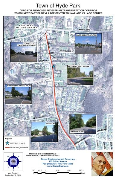
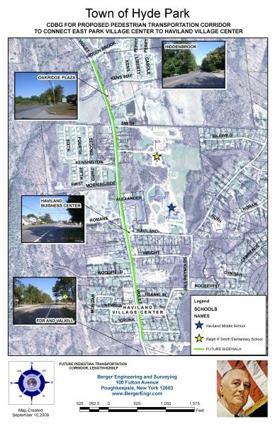
TOWN OF HYDE PARK
Hyde Park, New York
- Proposed CDBG pedestrian transportation corridor to connect East Park Village Center to Haviland Village Center along Route 9G in Hyde Park, New York
- Two maps were created in GIS displaying the future sidewalks in relation to the surrounding community
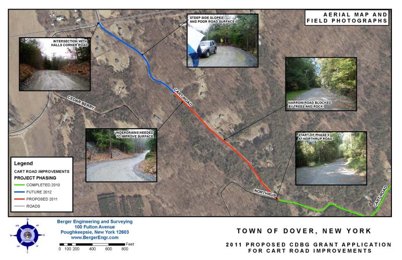
TOWN OF DOVER
Dover Plains, New York
- Proposed CDBG Grant Application improvements for Cart Road in Dover Plains, New York
- GIS was used to identify the Completed, Proposed and Future segments to be completed for Cart Road
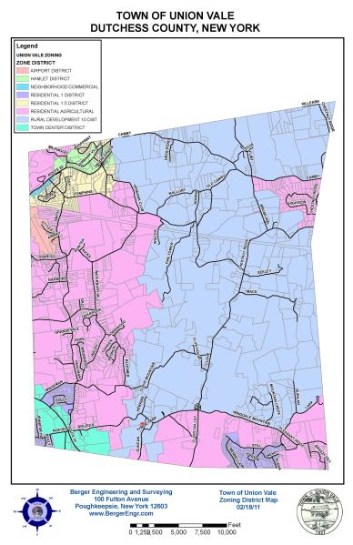
TOWN OF UNION VALE ZONING MAP
Union Vale, New York
- Used GIS to create a map identifying the different zoning districts located within the Town of Union Vale
- The map was published and is currently displayed on the town's website
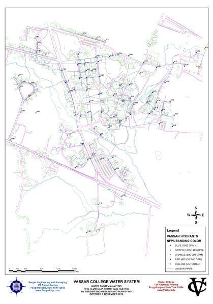
VASSAR COLLEGE HYDRANT ANALYSIS
Poughkeepsie, New York
- Tested GPM for all hydrants located on Vassar College property
- Used GIS to display the NFPA Banding Colors and GPM values for each hydrant
Town of
Hyde Park
South
Town of Dover
Hyde Park
North
South
Town of Dover
Union Vale Zoning
Vassar College
|
|
|||
Berger Engineering and Surveying | 100 Fulton Avenue | Poughkeepsie, NY | 12603 | Phone: 845.471.7383 |